
Sea Distance Calculator
Ships can’t sail through continents, so sea distance depends on the route. Pick a departure and arrival port, add the canals, straits and capes you’ll pass, and this calculator adds up the legs in nautical miles and tells you how many days the voyage takes at your chosen speed.
- Free to use
- No sign-up
- Runs in your browser
Quick answer
Distance between ports is measured in nautical miles (1 nm = 1.852 km) along the sea route, not in a straight line. Example: Rotterdam to Shanghai via the Suez Canal is about 10,440 nautical miles — roughly 31 days at 14 knots.
Sea distance calculator
Voyage Planning Template Pack
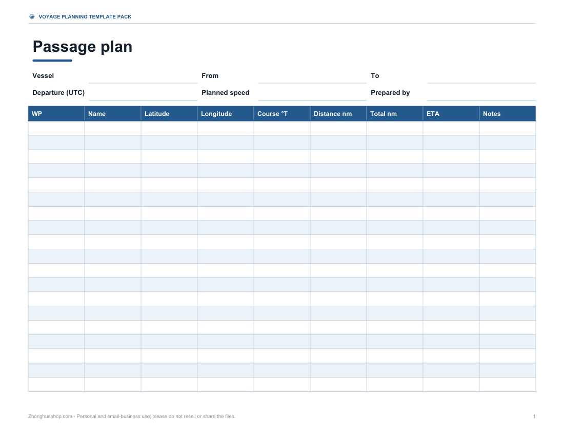
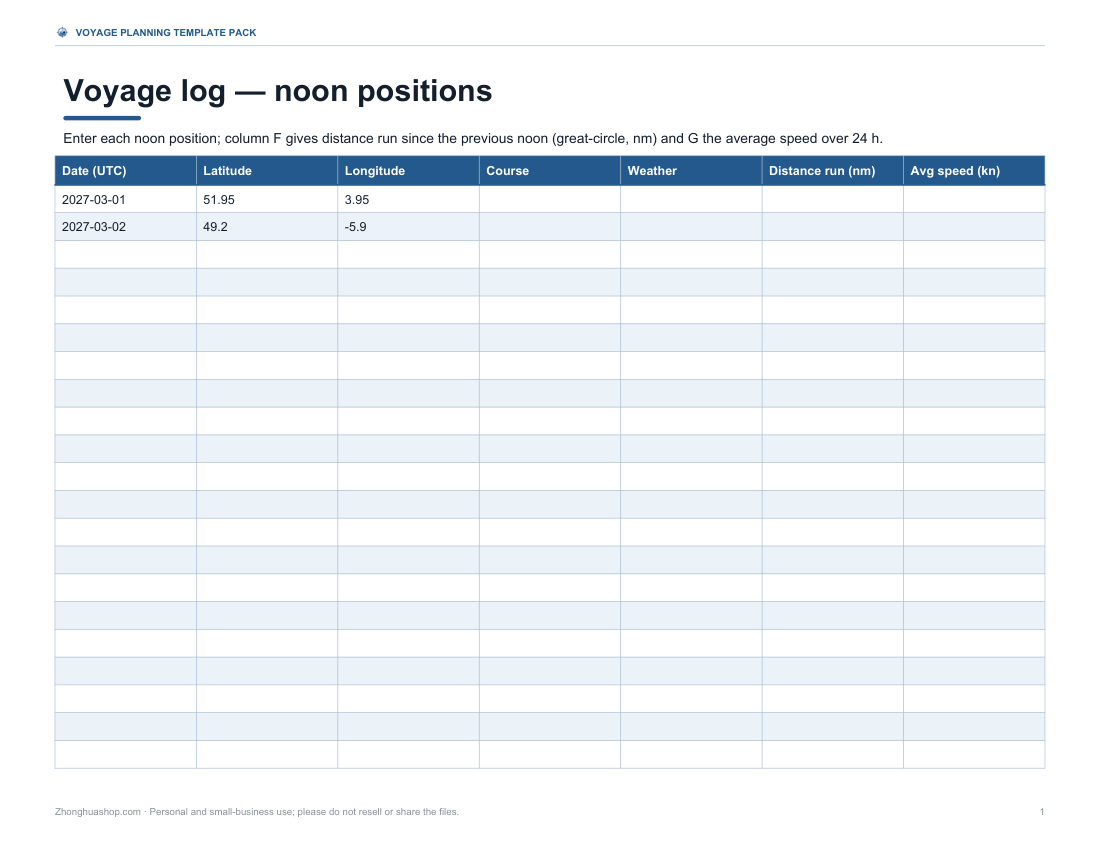
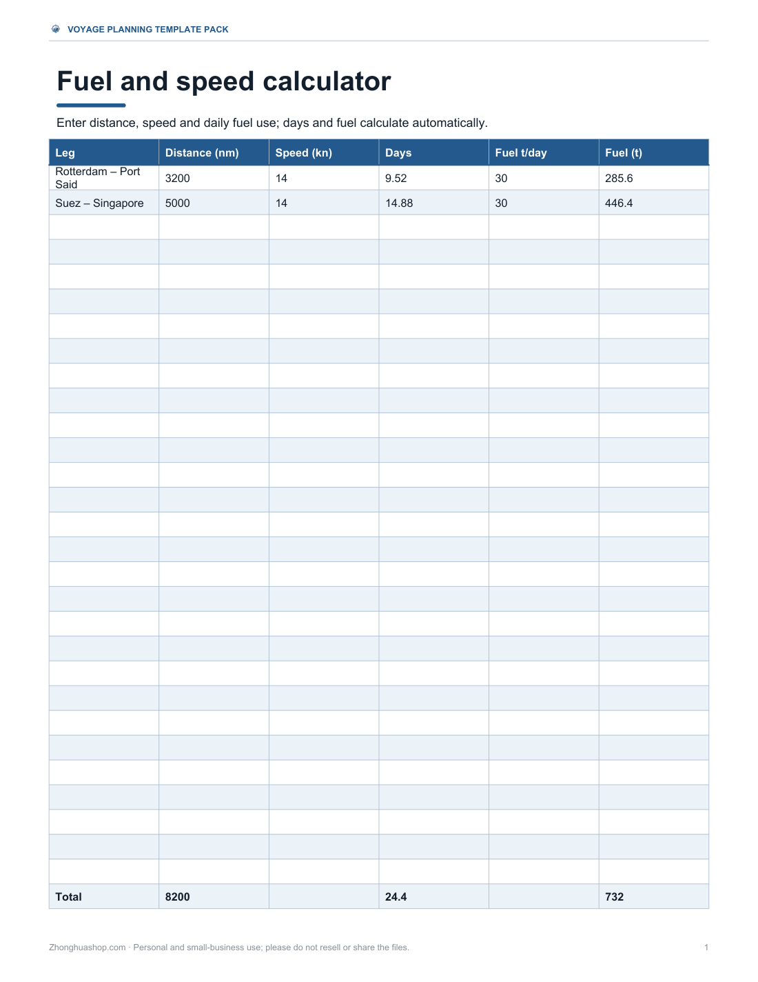
Passage plan template with waypoint table, voyage log spreadsheet with noon positions, a fuel and speed workbook, a port call checklist and a nautical conversion card.
- Passage plan (PDF/DOCX)
- Voyage log (XLSX)
- Fuel & speed (XLSX)
- Port call checklist (PDF/DOCX)
- Conversion card (PDF/DOCX)
Formats: PDF, DOCX, XLSX. Instant download after payment (link valid 72 hours, up to 5 downloads). AI-assisted: the templates were drafted with AI help and reviewed and laid out before publishing.
$5.00 USD, one-time 5 files · about $1.00 each
- Instant download
- 7-day refund
- Secure checkout by Stripe
7-day money-back guarantee. Full refund within 7 days of purchase, even after you download.
Free sample: Passage Plan (PDF, 99 KB)
Full refund within 7 days — see the refund policy and license.
Free printables
Single sheets you can print right now, no sign-up. The full pack adds every sheet in one download plus the editable files.
 Printable Passage Plan Template
 Printable Voyage Log
 Printable Fuel and Speed Calculator
 Printable Port Call Checklist
 Printable Nautical Conversion Card
Nautical miles between major ports
Shortest sea routes around land from the calculator above, with no allowance. Published distance tables can differ by a few percent because real tracks follow traffic lanes, so add the 5% routing allowance for planning.
| From | To | Route | Nautical miles | Days at 14 knots |
|---|---|---|---|---|
| Rotterdam | Singapore | via Suez Canal | 8,294 | 24.7 |
| Rotterdam | Shanghai | via Suez Canal | 10,441 | 31.1 |
| Rotterdam | Shanghai | via Cape of Good Hope | 13,729 | 40.9 |
| Hamburg (Elbe mouth) | Hong Kong | via Suez Canal | 9,984 | 29.7 |
| Shanghai | Los Angeles / Long Beach | direct | 5,817 | 17.3 |
| Shanghai | New York | via Panama Canal | 10,621 | 31.6 |
| Shanghai | Singapore | direct | 2,147 | 6.4 |
| Singapore | Dubai (Jebel Ali) | direct | 3,468 | 10.3 |
| New York | Rotterdam | direct | 3,290 | 9.8 |
| Santos | Rotterdam | direct | 5,465 | 16.3 |
| Singapore | Sydney | direct | 4,161 | 12.4 |
| Busan | Los Angeles / Long Beach | direct | 5,393 | 16.1 |
Nautical miles and knots
A nautical mile is 1,852 metres — about 1.15 statute miles — and was originally one minute of latitude, which makes it convenient on charts: one degree of latitude is 60 nautical miles. A knot is one nautical mile per hour. A ship at 14 knots covers 336 nautical miles a day; at 20 knots, 480.
Why the route matters
The shortest path between two points on a globe is a great circle, but at sea that line often crosses land. A voyage from Europe to Asia must go through the Mediterranean and the Suez Canal, or all the way around Africa via the Cape of Good Hope; from the US East Coast to the West Coast, through the Panama Canal or around South America. The calculator finds the shortest sea route around land for you, through the canals and straits where that is shorter; choose to avoid Suez or Panama to see the long way round, or add a waypoint to force the route through a particular strait or cape.
Worked example
Rotterdam to Singapore through the English Channel, the Strait of Gibraltar, the Mediterranean, the Suez Canal, the Red Sea and the Malacca Strait is about 8,294 nautical miles by sea, compared with a great-circle distance of 5,711 nm straight across Europe and Asia. Avoiding Suez and going around the Cape of Good Hope makes it about 11,830 nm. At 14 knots, plus a 5% allowance for routing and weather, the voyage takes about 25.9 days, excluding the Suez Canal transit and any waiting time.
Canal and strait shortcuts
| Passage | Connects | Typical saving vs going around |
|---|---|---|
| Suez Canal | Mediterranean – Red Sea | Thousands of nm on Europe–Asia routes vs the Cape of Good Hope |
| Panama Canal | Atlantic – Pacific | Thousands of nm on US East–West Coast routes vs Cape Horn |
| Strait of Gibraltar | Atlantic – Mediterranean | The only natural sea entrance to the Mediterranean |
| Malacca / Singapore Straits | Indian Ocean – South China Sea | Shortest route between India and East Asia |
| Dover Strait | North Sea – English Channel | Main route from northern Europe to the Atlantic |
Use the calculator to compare: build the route both ways and see the difference in days at your speed.
Great circle vs rhumb line
A great-circle route is the shortest path on a sphere but constantly changes compass heading; a rhumb line keeps one heading and appears straight on a Mercator chart but is longer, especially on east–west passages at high latitudes. Across the North Pacific the difference can be a few hundred nautical miles, which is why ocean crossings usually follow a great circle broken into rhumb-line legs between waypoints. Near the equator, or on mainly north–south passages, the two are almost identical.
Speed, time and fuel
| Speed (knots) | nm per day | Days for 5,000 nm | Typical of |
|---|---|---|---|
| 6 | 144 | 34.7 | Sailing yacht cruising |
| 10 | 240 | 20.8 | Slow steaming bulk carrier |
| 14 | 336 | 14.9 | Container ship (economical) |
| 18 | 432 | 11.6 | Container ship (faster service) |
| 22 | 528 | 9.5 | Fast ferry / cruise ship |
Fuel use rises steeply with speed — for many ships, roughly with the cube of speed per hour of steaming — so slowing down a few knots can cut fuel per voyage substantially even though the trip takes longer. Enter your vessel’s daily fuel use to estimate the total for the passage.
Time zones at sea
Voyage planning is normally done in UTC to avoid confusion as a ship crosses time zones. The ETA here is in UTC; convert it to the destination’s local time for port bookings. Ships’ clocks are usually adjusted by an hour at a time on long passages, and crossing the International Date Line changes the date.
Planning a voyage
- Pick the departure and arrival ports; add waypoints only where you need the route to pass a particular strait or cape.
- Add an allowance for real routing — traffic separation schemes, pilot stations and weather.
- Include canal transit and waiting times separately; they can add a day or more.
- Check fuel range and bunkering ports on long legs.
- Use official charts and sailing directions for actual navigation.
What’s in the template pack
- Passage plan template with waypoint table (lat/long, course, distance, ETA)
- Voyage log spreadsheet with daily noon positions and distance run
- Fuel and speed calculator workbook
- Port call checklist
- Nautical mile and knot conversion card
The calculator is free; the pack is a one-time download.
AI-assisted content
This page and the templates were drafted with AI assistance and reviewed before publishing. Port and waypoint positions are approximate and the results are for planning and education — not for navigation.
Frequently asked questions
How many nautical miles is it from Shanghai to Rotterdam?
About 10,440 nm via the Suez Canal (published tables give around 10,500 nm), or about 13,730 nm around the Cape of Good Hope. At 14 knots the Suez route is about 31 days at sea.
How long is a nautical mile?
1,852 metres, about 1.15 statute miles.
How is sea distance calculated?
As the shortest open-water route around land between the ports — through Suez, Panama and the main straits where that is shorter — built from great-circle legs between points at sea.
How many days from Europe to Asia by sea?
Often three to four weeks at typical container-ship speeds via Suez, longer around Africa.
What is a knot?
One nautical mile per hour.
Why is the great-circle distance shorter?
It ignores land; real routes must go around continents or through canals.
How far can a ship travel in a day?
Speed in knots × 24 — about 336 nm at 14 knots.
Is the ETA in local time?
It’s in UTC; convert to local time at the destination.
Can I add my own waypoints?
Choose from the built-in canals, straits and capes to force the route through them; for other positions, use the passage plan template in the pack.
Can I compare Suez with the Cape of Good Hope?
Yes — set Canals to “Avoid the Suez Canal” and the calculator routes around Africa instead.
Does the calculator include canal transit time?
No — add canal transits and waiting time separately; they often take a day or more.
Can I use this for navigation?
No — use official charts and publications.